Wednesday, August 31, 2011

It's All Down Hill From Here!

The first 30 miles of US Hwy 50 going east from Grand Junction -- where it splits from I-70 -- were absolutely terrible. There was so much heave to the roadway that I felt like I was riding a bucking bronco! It was so bad I actually considered abandoning it and switching over to I-70 toward Denver.

Thankfully, the road improved as I entered the mountains, and I enjoyed a pretty drive past ranches and farm land, over a few passes, through some canyons, beside a reservoir, etc. The weather was quite overcast, so the photos aren't very good and certainly don't do it justice.

The high point of the day -- literally! -- was crossing over Monarch Pass. At 11,312 feet, Monarch Pass is one of the highest elevation passes in the country, and I'm pretty sure it's the highest I've ever driven. Straddling the continental divide, it's all down hill from here!

As usual, Darth was perfect and I took this photo to commemorate his earning a high altitude merit badge to go with all the others he has already earned in his short but productive life.

Tomorrow, I plan to continue east as far as Pueblo, where I will take a detour up I-25 to Fort Collins and visit with a friend for the long weekend. Early next week I will swing back down to Pueblo and rejoin Hwy 50 for the rest of my drive east... Stay tuned!

Click here to see exactly where I am posting this from on Google Maps.

Tuesday, August 30, 2011

Eastern Utah

For the entire eastern two-thirds of Utah, US Hwy 50 has been replaced by I-70. The only remnant of the old route is the occasional sign post which identifies that you are on both roads. As an interstate, the roadway was wider but not discernibly any better. Highway 50 has been in extremely good condition for the entire thousand or so miles that I have driven it so far.

The scenery, however, has changed remarkably. Instead of very long flat stretches punctuated by occasional hill climbs, today was a series of very long hill climbs punctuated by occasional flats. Darth really got another work out today, and was as fabulous as ever.


Another difference today was the presence of viewpoints and turn-outs at regular intervals. I took advantage of several, much to our mutual enjoyment (I hope).

I'm now just over the border in Grand Junction, Colorado, and planning to continue east in the morning.

Click here to see exactly where I am posting this from on Google Maps.

Monday, August 29, 2011

Welcome To Utah!

Between Ely (NV) and Delta (UT), Highway 50 shares the road with US Hwy 6 -- also called the "Grand Army of the Republic Highway" -- which runs from the tip of Cape Cod in Massachusetts to the Pacific coast in Long Beach, California. It's another of the great old highways and definitely a candidate for one of my future road trips… Someday, maybe.

For today, the convergence of 50 and 6 was simply one of the few novelties in the otherwise barren desert. The desert drive was again fantastic, mind you, but you can see how it was nice to have some interesting signs to look at along the way.

It's hard to describe what it's like to drive from this point -- in an absolutely straight line -- for 15 minutes before you reach the mountains!

The stop where I took the photo above was at the NV/UT border, and here's the sign which makes it official. I've driven on to Richfield, UT, and plan to continue the rest of the way across Utah to Grand Junction, CO, tomorrow.

Click here to see exactly where I am right now on Google Maps.

Sunday, August 28, 2011

198th Street, Ely, NV

I talked with my mom this morning, and she told me she likes the new map links I've started posting. She said that while looking at the satellite view of Ely, NV, she had a chuckle about the next intersection to the south of my present location and would love to see a picture of what 198th Street looks like in such a small town.

Since I always do what my mother wants me to, here it is.


I have to admit it was an amusing sight, with no evidence of the 197 streets that might precede it.

Saturday, August 27, 2011

Awesome Day On "The Loneliest Road In America"

What an awesome drive I had today! More than 250 miles on "The Loneliest Road in America" took me across seemingly endless stretches of desert, often on a roadway that was absolutely straight for ten or more miles. I crossed numerous mountain passes -- several 7,500+ feet in elevation -- but only passed through very few, very small settlements. It was probably the single most awesome day I've ever spent on the road!

About 100 miles into my drive, I stopped in Austin for something to eat at the International Cafe. I was the only customer in the place, so the young waitress Brittany and I made small talk while I ate my sandwich.

She has just graduated from Austin high school where her senior class numbered an "unusually large" four students. Next year's class will be just two boys, about normal in a town of 300 or so people. Austin is one of the two "big towns" on US Hwy 50 between Fallon and Ely… Got it?

About an hour further down the road, I needed to make a personal pit stop. There are very few places to pull off the road, but since I could see there was no traffic for 5-10 miles -- which equals about 5-10 minutes -- in both directions, I just slowed to a stop and got out. I also took the opportunity to snap this photo of Darth, who performed spectacularly on what may well have been his single most difficult day of driving ever!


I've looked through all the photos from my DashCam, and picked out the one above as being the single best to share with you as an example of what I experienced all day today: Long straight drives punctuated by distinct mountain passes. What a day!

I've pulled into a KOA here in Ely and booked myself in for two nights. I plan to take it easy tomorrow, probably do a little exploration of this little town, and catch up on a few chores. Come Monday I'll be back on the road headed east and into Utah… Stay tuned!

Click here to see exactly where I am on Google Maps.

Friday, August 26, 2011

Fallon, NV

I was up and out of Placerville early, immediately starting a long climb. This was followed by a pretty steep descent, then the "real" long climb to Echo Summit over 7,000 feet. Darth performed spectacularly -- dialed in at 50 mph, 2000 rpm and 35 lbs of boost! -- and we rarely had to pull out to let fast cars pass. Sadly, none of the pull-outs were at good viewpoints, so you'll have to settle for a decent DashCam shot of the pretty, alpine scenery.


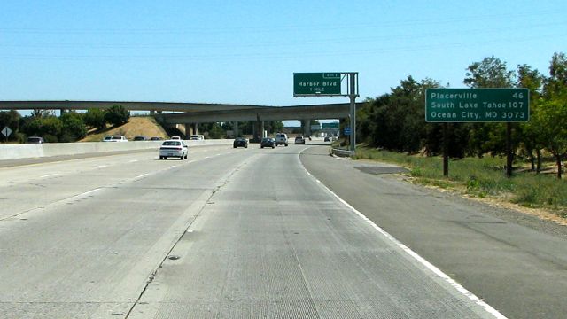
We blew right through South Lake Tahoe and continued over another pass, then steeply down to and through Carson City. In a matter of minutes, the terrain had dramatically shifted from forest to desert, and the road became flat, straight and hot.


The actual roadway has been excellent -- smooth pavement, little slope, etc. -- and we were really cruising when we pulled into Fallon, NV. The heat of the day and the long distance to the next possible stop-over combined to make Fallon my home for the night.

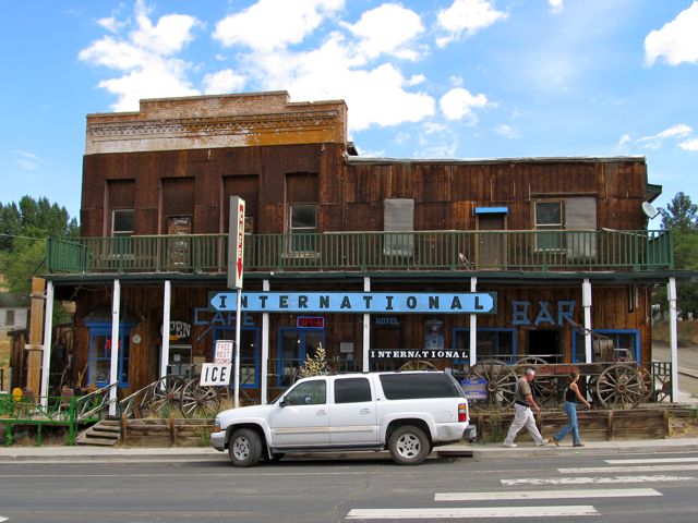
I arrived early enough that after parking my rig I had time to visit a number of the local attractions, including the excellent -- by any standards -- little museum. My favorite display is this old guy and his dog on the wagon. I envy him having a dog, but there's no way I'd trade Darth for his rig!


This part of US Hwy 50 being "The Loneliest Road in America" is a theme that's guaranteed to be beaten to death by the time I've finished it. I did pick up my "Loneliest Road" passport and survival guide, and we'll just have to see if I get it stamped at all the requisite places and send it in for an "I Survived…" certificate. (Bets, anyone?)

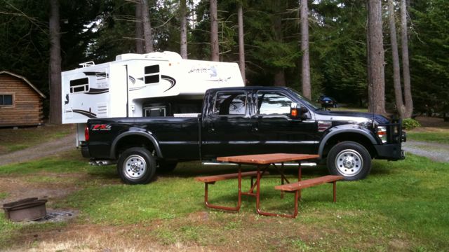
It may be a "dry heat" but it's still crazy hot for me, so I'm hanging out in my Arctic Fox camper -- there's a joke in there for sure -- with the air conditioning on. I plan to push east tomorrow, either 100+ miles to Austin or 250+ miles to Ely, depending on stops, sights, camping options and, of course, the heat. Stay tuned!

PS -- Just for fun, I'll try to remember to post my GPS coordinates so you can click to see exactly where I am on Google Maps.

Thursday, August 25, 2011

US Highway 50 -- "End-to-End" Officially Begins!

Although I was up and out of my Petaluma campground in proper form this morning, I got pretty well hammered by traffic the minute I left the gate. Between that and a stop at Starbucks, it was late morning by the time I approached Sacramento and the official start of US Highway 50 eastbound.


I've zoomed in on the sign in this photo from my DashCam, simply because it made me smile: Only 3,073 miles to go!

I only drove another 50 miles or so today -- over some fair to good road with fair to poor scenery and moderate to steep climbs-- and stopped just as the heat of the day really set in. Darth's got about 5,000 feet of elevation to gain tomorrow, and I want him to do it early in the morning when, hopefully, it will be cooler.

So, my US Hwy 50 road trip has officially begun!

Wednesday, August 24, 2011

Changing Direction: Turning East On US Hwy 50

I've decided to suspend my road trip along US Hwy 101 and start heading east on US Hwy 50. My reasons for doing this are three-fold:
First, driving US Hwy 50 "End-To-End" has always been the primary goal of this extended road trip, and it starts just a few miles east of where I am now. Completing US101 prior to turning east on US50 would mean driving all the way down to the southern border and all the way back up. That's guaranteed to include a ton of traffic, etc., in addition to the miles. I'd rather pick up the last part of 101 on a future road trip.

Second, I'm honestly not finding US101 all that interesting. The Oregon coast was lovely, but since the road turned inland here in California it's been kinda boring. The road continues inland for almost all of the remaining route, and that doesn't bode well going forward. Again, I'd rather pick up the lower third of the route some other time.

Third, and most compelling, I've just been invited to participate in a truly fantastic expedition that begins on the east coast sometime mid-October. I can't tell you anything about it yet, but it's very, very exciting. If I tried to finish US101 I'd then have to move really fast on US 50, and that would kinda defeat the purpose of the road trip!
So, tomorrow morning I will change direction and turn east on US Hwy 50.


U.S. Route 50 is a major east–west route of the U.S. Highway system, stretching just over 3,000 miles (4,800 km) from West Sacramento, California to Ocean City, Maryland on the Atlantic Ocean. The route runs through mostly rural desert and mountains in the Western United States, with the section through Nevada known as "The Loneliest Road in America".

In the Midwest, US 50 continues through mostly rural areas of farms as well as a few large cities including Kansas City, Missouri; St. Louis, Missouri; and Cincinnati, Ohio. The route continues into the Eastern United States, where it passes through the Appalachian Mountains in West Virginia before heading through Washington, D.C. and on to the coast. (From Wikipedia)

Does that sound great or what? Stay tuned!

Monday, August 22, 2011

Approaching "The Bay Area"

I had a nice, long drive through northern California yesterday. The "Redwood Highway" started out in the trees and hills, then broadened and flattened the further south I got. There were a number of places where recent landslides were evident, obvious both in the landscape and in the many bumpy, patched-together spots in the road. For the record, US 101 is a fairly inconsistent road in terms of width, grade and quality. Something to keep in mind if you ever drive it.

The scenery dried out pretty quickly and vast vineyards began to appear, frequently crowding right near the road. As I got closer to "The Bay Area" the traffic really started to thicken, quite a change from my driving experience over the past three weeks.

I've stopped in Petaluma, taking up residence for a few days at a very large KOA campground and enjoying the company of neighbors from different parts of Europe. Petaluma seems like a nice enough town that's close -- but not too close -- to San Francisco. I'm hoping to meet up with some friends in the area while I'm here.

I took Darth to the doctor today, to have an odd little noise checked out. I think it's as simple as a pebble caught in a backing plate -- a very minor, simple thing to fix which he's had before -- but you know how much I rely on him, and I do my best to give him the best care possible. Stay tuned!

Saturday, August 20, 2011

Flashback: Aleutian Islands

I've just completed posting about my 2010 expedition to the Aleutian Islands, the last of the new content from my Alaskan Summer travels.

You can access it all by clicking here.

At the very least, don't miss the grizzly bears!.

Just a little more to go and this website will finally be completely up-to-date with everything from the World of Macgellan!

Friday, August 19, 2011

Babe Be Blue? Aye, Yes!

(Note: That's another post title you may have to say out loud to catch my attempt at humor.)

There were a couple of very long uphill pulls heading south out of Crescent City, but trusty Darth just did his thing to get us up and over them... Good boy, Darth!

Shortly after, we pulled in to see the extremely large statues of Paul Bunyan and Babe (the blue ox) at the popular Trees of Mystery tourist attraction. I didn't check it out past taking the requisite photo and getting coffee, then headed on down the road to the town of Fortuna.

The road has now turned inland a bit, and I hope to get some good views and photos of the majestic redwoods. Before leaving the coast, though, I had one last glimpse of the rugged, foggy shoreline.

Thursday, August 18, 2011

Greetings From California

There's not much south of Bandon, mostly just cranberry bogs, berry farms, dunes, grassland and the occasional glimpse of the coast. I pulled over to enjoy and photograph a few of them, but once in a while they just popped up in front of me as you can see in the shot from my DashCam.


An interesting aspect of the Oregon coast that I've wanted to share with you is the large number of "Deco-ish" bridges along the way. This shot -- also from my DashCam -- shows you a good example. They're a nice alternative to the typical highway span, though after a while they too become routine.


About mid-day I hit the Oregon-California border and got a kick out of the "Farewell / Hello" road signage. I don't know why, but this little hospitality competition between states amuses me.


Just over the border, I had to pull over for the California "agricultural inspection" which consisted of a guy asking me if I had any fresh fruit or fire wood on board. My bag of grapes was no problem for the man, so he just handed me a map of the state parks and wished me a pleasant day.

Shortly after that, I passed the first really tacky tourist trap of this road trip. There were a few "roadside attractions" in Washington and Oregon, but they were mostly small, unobtrusive and more-or-less fitting to the locale. The "Ship Ashore" is something else entirely. It is also "Closed Til Feb" which leads me to believe it is closed for good.


I pulled into a campground north of Crescent City, unhitched my sled -- which I'm really liking the ease of -- and went into town. I was back at my camper about an hour later, which probably says all I need to about Crescent City. I'm going to hang out here today, then continue south in the morning.

Tuesday, August 16, 2011

Bandon, OR

Bandon is my favorite place so far on the Oregon coast. It's got a beautiful, wide open beach, a nice little "old town" and a good selection of shops, restaurants and coffee joints. Plus, the weather has been perfect, which always helps.


The best thing about Bandon in my opinion, though, is that it's got a quiet, laid-back, almost unnoticeable tourist scene. There are some touristy kinds of places, but even those seem to be pretty low-key and unobtrusive.

Most folks seem to be "regulars" who come here to hang out and enjoy the peace and quiet. I am by far the youngest person at my RV park, and the only one to arrive and leave in the same week.

Throw in the Subway and the laundromat... Heck, I could hide out here for a long time! In reality, I'm heading south again tomorrow, perhaps into northern California.

Flashback: Alaskan Summer Travel 2010

I've just uploaded a ton of content from my summer 2010 travels around the state of Alaska.

This material is all new to the web, so I encourage you to check it out!

You can access either all or specific parts of it using the links under "Alaskan Summer Travel" over in the side-bar. Or, you can access it all by clicking here.

I hope you enjoy this flashback... Have fun!

Monday, August 15, 2011

Welcome Facebook and Twitter Friends/Followers!

I've just activated the feed from this new website to my Facebook and Twitter accounts... The idea is to make it easy for my Facebook/Twitter Friends/Followers to travel along with me... I hope it works!

Sunday, August 14, 2011

Viewpoints

I generally don't drive very fast, but today I was slower than ever. Not because of any driving issues, but because of all the viewpoints I turned out at to take a look. It seemed like I was stopping every 10 minutes to enjoy the next insanely beautiful view of the Oregon coast:


As you can see, I transitioned from bluffs and rocks south of Waldport to some pretty spectacular -- and famous -- dunes on my way into Bandon. I've been informed that Bandon is a wonderful, funky little town, so I expect to be here for a couple of days... Stay tuned!

Thursday, August 11, 2011

Oregon Coast

It was overcast and drizzling for most of my drive to the southern border of Washington and across the bridge into Astoria, Oregon.

The wetlands along the coast are pleasant, but there's a reason people take the fast lane on the interstate to get to the Oregon coast: There's just not much too see in southwestern Washington.

I spent a couple of quiet nights in Astoria, then continued down the coast yesterday.

As you can see, there's a reason why "The Oregon Coast" -- as it's always called -- is so popular. If this photo of Canon Beach doesn't hook you, check your pulse.


I had intended to stop in Newport for a couple of days, but the tourist throng was too thick for me. So, I kept going a little farther to the much more laid back town of Waldport. I've found a sweet little campground right on the beach/inlet and plan to spend a couple of days here. Poor me!

Saturday, August 06, 2011

"Rainforest, Rain!"

(Note: You may have to say the title of this post out loud to get my little joke. Be sure to emphasize the "rain" parts both times!)

Aptly, it rained for my entire drive west and south through the Olympic Peninsula rainforests. I did make a quick stop at Klaloch Beach for a photo, however, before pushing on down to a little campground I like in Hoquiam, WA.


Hoquiam is one of those "dead" old industrial towns that I find so interesting. Once a major logging center and port, it's now a somewhat frayed home to about 9,000 people. I wandered up and down the "main" streets until I found the saddest looking diner I could and went in for lunch. It felt kind of like going to the pound and picking out the shabbiest dog in the joint. Somehow you just gotta do it. Not surprisingly, however, the place and its people had the best personality, a fine cup of chowder and a pretty damn good BLT!

I'm going to stay here for another day then continue south along the coast to somewhere around the Oregon border.

Thursday, August 04, 2011

The "Northern Origin" of US 101

I hit the road in earnest yesterday, immediately opting to abandon any thoughts I had of beginning US 101 at it's official origin in Olympia, WA. Frankly, I just didn't care for the idea of driving all the way south to Olympia, then all the way north to Port Angeles -- a long day's drive on roads I've already driven a dozen time -- just to meet a technicality.

Instead, I drove from Seattle to Mukilteo and caught a ferry to Whidbey Island, had lunch with my good friend Jeni, then hopped another ferry across to Port Townsend. From there it was just a nice little drive to Port Angeles -- which is really the "northern origin" of US 101 -- where I checked into a pretty little campground.


Thus, you can see that my "Road Rig" has taken it's first two ferry rides -- both on the same day -- and looked quite nice in the process. You can also see that I've made good use of the "quick release" aspect of my camper sled to make Darth available unencumbered. Which was really helpful, because today I drove into Port Angeles town to do some chores, have lunch and look around. I also scouted out the closest thing to the "northern origin" and found this marker where US 101 switches from "North" to "West" signage.


That's really all just a bunch of mumbo jumbo. The point is, I am at what I'm calling the northern origin of US 101 and ready to head west/south in the morning!

Monday, August 01, 2011

US Highway 101

Sometime in the next couple of days, I'm going to hit the road again!

U.S. Route 101, or U.S. Highway 101, is an important north–south U.S. highway that runs through the states of California, Oregon, and Washington, on the West Coast of the United States. It is also known as El Camino Real (The Royal Road) where its route along the southern and central California coast approximates the old trail which linked the Spanish missions, pueblos, and presidios. It merges at some points with California Highway 1.

The nearly 2,500 km (1,550 mi)-long highway's "northern" terminus is in Olympia, Washington, though the northernmost point on the highway is in Port Angeles. The southern terminus of U.S. 101 is in Los Angeles, California at the East Los Angeles Interchange, the world's busiest freeway interchange. (From Wikipedia)


None of my interests in US 101 are particularly compelling, though taken all together they make for a good enough reason for me to choose it: It is a classic old US Highway, it stretches all the way from the northern US border to the southern border (if you continue on the decommissioned part south of Los Angeles) and it generally runs either along the beautiful Pacific coast or through some nice slightly inland portions of California. Being the westernmost US Highway, it also offers an appealing correlation to my northernmost drive on US 2 back in 2009.

I find that I really like the old US Highways. Rolling through smaller towns is far more interesting to me than cruising down an Interstate. Plus, there are an endless number of places to stop, things to see and -- perfect for me -- places to camp. I remain intrigued by the idea of driving them "end-to-end" like I did with US 2, but I'm not sure I'll do that on US 101. If it starts getting too hot -- or too congested in southern California! -- I may bail out. We'll just have to wait and see!