Friday, September 22, 2017

Happy: States I've Peed In Update!

Hi, it's me, Happy! Giving you an update on states I've peed in. Look at my new map!


I've told the boss we need to make a New England circuit and a trip to the Deep South. He says we might do just that! How am I going to pee in Hawaii?

Wednesday, September 20, 2017

US12: No End In Detroit

Happy and I had a leisurely morning. We found a great park for her and a nice little air museum -- Yankee Air Museum -- for me. Her park featured plenty of grass and a tree lined path. My museum featured a small but well displayed collection of aircraft, informative historical information and educational displays for kids.

This afternoon we drove the last few miles of US12 into downtown Detroit. It is obviously a very heavily used urban arterial. Quite a change from the wide open range out west!


It turns out that US12 is now the only US Highway route still serving downtown Detroit, whose street grid was laid out by Augustus B. Woodward, to have a five-way intersection of the roads that would become US12, US10, US16, US112 and US25. With all that heritage, you would think the end and beginning of the route would be well marked. You would be wrong.

Instead, US12 ends not with a bang but a whimper at Cadillac Square, with not so much as a sign of any kind. At least not one that I could find after several reconnaissance circuits and some boots on the ground scouting. So, once again on the Voyages of Macgellan, to seek, to strive, to find, but not to yield. Here's a photo of how 2500 miles of famous road ends:


Despite the signage disappointment, this has been another worthwhile road trip across America. One of these days I'm going to put together a composite map of all my cross-country drives. I'm afraid I would shock myself. For now, I'm calling it a wrap on US12 and heading to Pennsylvania. Depending on how all that goes, I'll make plans for returning to the Pacific Northwest... Stay tuned!

Tuesday, September 19, 2017

US12: Michigan Heritage Route

US12 enters Michigan from Indiana, southwest of New Buffalo, as a typical two-lane affair. The addition of roadside tree stands makes it very different from the many miles we've driven before. It's a 55 mph road, frequently punctuated by 30 mph towns, which makes it seem very slow compared to the 75+ mph we've become accustomed to. Nevertheless, it is a nice, easy drive. The weather was overcast and drizzly all day, so no great photos. This one is pretty typical.


In 2004, The Michigan Department of Transportation designated 209 miles of US12 from New Buffalo to Detroit as Historic Heritage Route. Many of the standard signs are thus adorned by additional designation.

"US-12 is among the oldest road corridors east of the Mississippi River and accesses some of the most extensive and significant historic, cultural, scenic and recreational resources in Michigan. It begins in downtown Detroit, just blocks from the Detroit River, and extends through southern Michigan to the Michigan/Indiana border south of New Buffalo.

"It was originally a network of centuries-old trails created by Native Americans. Over the years it has had many names such as Sauk Trail, Chicago Road, and Michigan Avenue." — Pete Hanses, MDOT's Heritage Route manager

Happy and I don't like to stay in downtown metro areas, so we have stopped just short of Detroit. Our plan is to finish the last few miles tomorrow and see if we can find any US12 "End" or "Begin" signs... Stay tuned!

Monday, September 18, 2017

US12: Getting Ready For The Last Leg

After a really good night's sleep, Happy and I went to Starbucks where we both had brief, passionate love affairs. Mine with a dark Komodo Dragon, Happy's with a 6 month old, intact male Chocolate Lab. Mine was really good, but hers looked better. My old girl's still got game with the boys!

After that, we found a very nice nature preserve in Michigan City and enjoyed a lovely walk together.


Not much to report besides that. Some sorting out of gear, raking trash out of the truck, basic getting ready to go for the last leg on US12 to Detroit tomorrow... Stay tuned!

Sunday, September 17, 2017

US12: The Longest Day

Happy and I had a day off in Willmar, MN, yesterday. We found a nice park for her to run around in, but only a closed-on-weekends museum for me. Dogs rule! Otherwise, we hung out, relaxed and went to bed early.

Possibly because of the extra rest but mostly because of noisy neighbors, I was wide awake at 1am. I looked over at Happy and saw she was sitting upright in her bed, looking for guidance. I said "Why not?" and she wagged her tail, so we got up, packed up and hit the road in the dark of night.

US12 east of Willmar, MN, is a two-lane affair that passes through a seemingly endless series of small towns. It was dark and misty out, so I saw very little and you'll see even less. Approaching Minneapolis, US12 turns into I-394 then becomes part of I-94. Shortly after St. Paul, US12 branches off and continues as a rural road.

As it became light, we were able to see many small, tidy, prosperous-looking Wisconsin farms.


We stopped for breakfast shortly after dawn and found that we had already traveled as far as we'd planned to for the day. While pondering what to do, it occurred to me that Sunday might be a good day to get around Chicago. So, we got back on the road and kept moving.

US12 weaves around I-94 all the way to Madison, WI, forming the western beltway of that city. It's not as fast as the interstate, but the variety helped keep me alert. After Madison, US12 becomes a road of its own, cutting diagonally SE to Chicago. It is an alternative to I-94 which heads east to Milwaukee then south along the shore, and I-90 which heads south to Rockford then east.


The route is so significant that it is cosigned as an alternate to the interstate most of the way.


The traffic was heavy despite it being Sunday, but we made reasonable time approaching Chicago. As always, I decided not to drive the surface streets through downtown, opting instead for a quick interstate bypass. Before long we were into Indiana and have stopped in Michigan city, where we planned to be tomorrow night.

The "bad news" is that we drove over 12 hours today. The "good news" is that we've banked ourselves another day off tomorrow! We were in this area a few years ago on US20. As I've posted before, pretty much all the roads "pinch" around the bottom of Lake Michigan. Right now, US12 and US20 are only a mile or so apart, with US14 and US18 thrown into the local mix.

We'll see what tomorrow has to offer in the area, with plans to head for the terminus of US12 in Detroit on Tuesday... Stay tuned!

Friday, September 15, 2017

US12: Into The Green

Basic meteorology: "Put your back to the wind. The high is on your right, the low is on your left."

Puling out of Mobridge, SD, this morning, the wind was strong from the left, so you can bet we were heading straight into the low pressure zone. True to form, it rained consistently -- with some heavy downpours -- the entire 200 miles across eastern South Dakota.

The fog was also very thick at times. From the few glimpses I got, it didn't seem we were missing much in the way of view. Perhaps gradually improving farmland and a few tiny towns, but not much.


Crossing into Minnesota, you're definitely in the green, with proper corn fields as far as the eye can see on both sides of the road. The rain gradually let up and the sun peeked through at times.


Happy and I are in Willmar, MN, which seems like a nice, mid-size town. So, we are going to take a planned two night break here... Stay tuned!

Thursday, September 14, 2017

US12: Dakota Dash

The last 75 miles of US12 in Eastern Montana transit stark, rugged country that my DashCam photos can't really capture. I don't think I can describe it either. The remaining wildfire smoke gave it an even more foreboding feeling. Let's put it this way: If you drive this road, make sure your vehicle is in good shape. You wouldn't want to get stuck out here.


Crossing into the southwest corner of North Dakota, US12 runs for about 90 miles to the southeast before hitting the South Dakota line. The scenery remains the same, and we only stopped once for a few minutes so that Happy could add ND to her list of state's she's peed in.


Paralleling close to the northern border of SD then continuing to the southeast, the landscape rapidly becomes much greener. There is organized farming, with large hay fields and even some short corn. We've finally gotten away from most of the wildfire smoke, so the whole setting was much more pleasant. I always love to drive the lonely roads of rough lands, but it's good to see green again.


After passing through a half-dozen very small towns over the course of the next hundred miles, you suddenly see a large body of water which is the Grand River Lake. Just a few miles later, you see an even bigger body of water and cross the Missouri River.


Happy and I have stopped for the night in the town of Mobridge, SD, which one would guess gets its name from the "MO (river) Bridge" right outside my window. Tomorrow should get us into Minnesota... Stay tuned!

Wednesday, September 13, 2017

US12: Miles City MT

There's still a lot of wildfire smoke in the air, but Happy and I both needed a day off from the road. So, we had a lazy morning, renewed our motel registration, then headed out to see what Miles City has to offer.

Being a "dog first" expedition, priority number one was to find a pleasant diversion for Happy. The local parks do not allow dogs on the property -- which tells you a lot about the town! -- so we drove a few miles to Pirogue Island State Park. Apparently, this is a place where the Voyage of Discovery crew spent some time on the banks of the Yellowstone River.

Happy filled her snout with all kinds of new smells while I did battle with mosquitoes. Having "deep woods" repellent helped, but I was still a swatting maniac. I took a few hits, but got my share of the enemy in return. Happy got her fill then drank an entire bottle of water. Yes, it is that dry here!


Next, we made a "human stop" at the Range Riders Museum. It is a sprawling campus of buildings, crammed full of just about everything they could get their hands on.

There are a warren of rooms in the main buildings which display saddles, ropes, guns, furniture, fixtures, etc. I reprise my suggestion to museums that they be more selective about what they display. Sometimes more is too much.

In one large banquet hall, the walls are covered with commemorative pictures of people. In another, there are hundreds of pictures of "famous cowboys." In yet another room, there are hundreds of pairs of boots on pedestals. You get the idea.

Of course, there's a reconstruction of old main street.

What's good about the museum is that it does a thorough job of explaining Miles City's history.

The first major milestone was becoming a center of cattle and other livestock ranching. Vast grazing lands, ample water and entrepreneurial individuals were essential in this phase.

Next was the establishment of a large military presence for fighting the frontier wars. There's a lot to that story, of course, so just keep in mind that The Little Bighorn is about 100 miles southwest of here.

Third was development of a major rail hub. In addition to being a transportation hub, vast maintenance and service facilities were built here. Being just about halfway between Chicago and the West Coast helped account for this development.

Don't get me wrong, it's a good museum and worth a visit if you're in the area. Just keep your head down and try to focus on the good, big picture stuff. Otherwise your head might explode.

For me, the highlights were the large, well done dioramas of various development phases, along with audio descriptions. Here's a photo of the one showing Fort Keogh:


It's been a lazy afternoon of sorting gear, checking maps, fueling up the rig and getting ready to hit the road tomorrow morning... Stay tuned!

Tuesday, September 12, 2017

US12: Rural Even By Montana Standards

The 592 miles that US12 traverses through Montana's mountains and plains is the greatest distance it runs through any state along its entire length. That's not really a surprise when you know how big Montana is, but driving 343 of those miles today really put it in perspective. As my friend in Helena explained, "You're heading into rural territory, even by Montana standards!"

After a short stint as a divided four-lane highway coming out of Helena, the road heads east through mixed landscapes of mountains, valleys, plateaus and plains. Signs indicated we were running through the Helena National Forest, and it was quite pretty and fun to drive. The wildfire smoke is still very bad -- and annoying -- but the views continue to prevail.


After 100 miles or so, the landscape becomes quite barren, with only the occasional cow trying to scratch out a living. There are a few very small towns spaced every 20 miles or so, but you really have the feeling of being "out there." For the next 200 miles I rarely saw another vehicle, and the miles sped by at 70mph. If you love to drive empty roads very fast, this part of Montana is for you.


Happy and I have stopped in the town of Miles City for the night. A population of 8,500 makes this by far the biggest metropolis in the area. We are overdue for a day off, so we might stay here tomorrow if the smoke clears at least a bit. If not, we may continue to push east into clearer air... Stay tuned!

Monday, September 11, 2017

US12: Over The Continental Divide... Again!

As per plan, a short drive today, only 100+ miles from Missoula to Helena, MT. I don't like to drive all day every day and I have an old friend here in Helena who has excellent taste in food and wine!

Immediately out of Missoula, the first half of the drive was a super fast -- 80mph! -- stint where US12 has been subsumed into I90. It's not bad as interstates go, with typical Montana big skies, rolling hills and scrub forests. The wildfire smoke is very heavy in places, but the views still manage to hold up.


Breaking off on it's own again, US12 continues to Helena. The drive is very pretty, with the high point -- literally -- being the sweeping view at 6,300 feet from the Continental Divide at MacDonald Pass.


My plan contemplates an extra day here in Helena, but Happy and I are pretty eager to get out of the eye-stinging smoke. So, we will push on tomorrow and try to get east of the fires sooner than planned... Stay tuned!

Sunday, September 10, 2017

US12: Lewis & Clark Trail

Much of US12 so far has also been designated as the Lewis & Clark Trail. This is overwhelmingly the case from Walla Walla to the Idaho border. It seems like every mile or so there is a turnout for a historical marker.

Driving through what I would call vast open plains and agricultural fields, I found myself wondering whether the Voyage of Discovery was happy about being there or not. My gut said probably not so much.


Happy and I skipped most of the minor turnouts, but made good use of one major rest area. Reading the sign confirmed for me that the lads were pretty well worn down by the time they made it back to this area from their winter on the coast. Happy used her time to check pee mail.


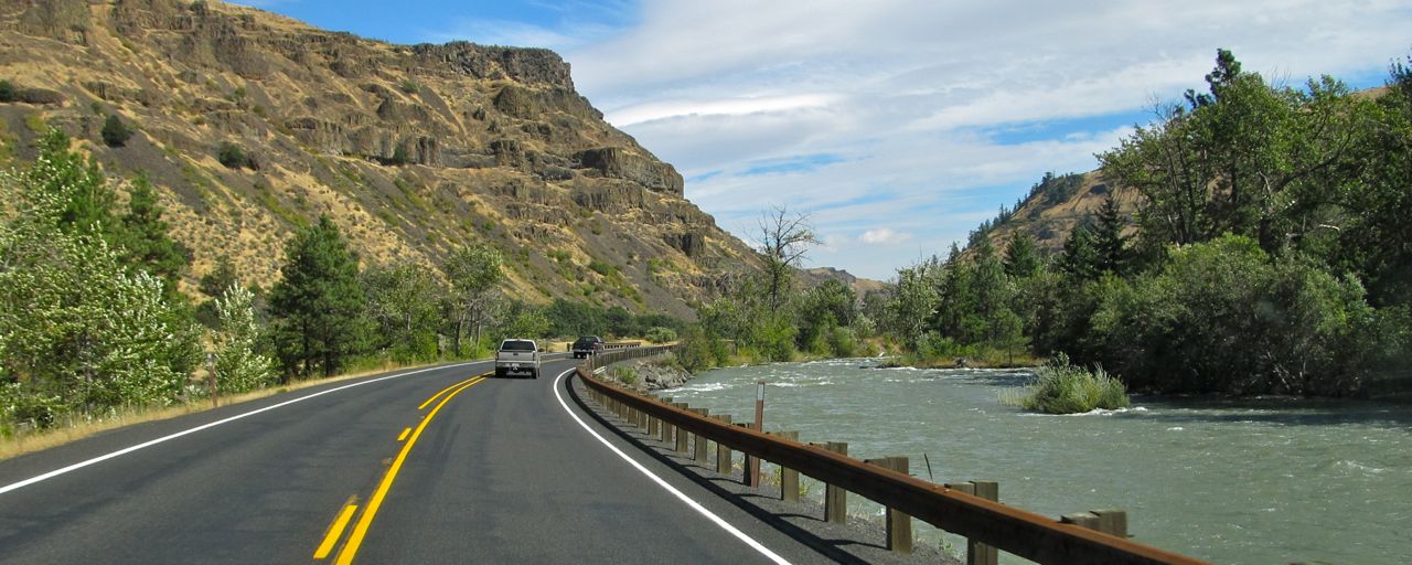
After crossing the Snake River at the eponymous towns of Lewiston and Clarkston, the scenery changes dramatically as the road heads up the Clearwater River valley. The next 200 miles of highway are spectacular, one of the best stretches of road I've ever driven. Two lanes the entire way, it starts as a meandering affair alongside a substantial river. Residual smoke from recent wildfires might have dimmed the view a bit, but it was a stunning drive the entire way.


As you head farther and higher up the valley, the road becomes an almost constantly twisting challenge, punctuated only occasionally by straights barely long enough to grab a gulp of coffee. Much of the way, the river stays strong enough for recreation in the Clearwater National Forest. Eventually, of course, it gives up the fight and dwindles to a trickle before ceasing entirely.


After a final hard push to the top, you reach Lolo pass. Not the most scenic of passes, nonetheless notable as the border with Montana. The downhill run is not as bad as the signs would indicate, and pretty quickly becomes a fast two lane sprint toward Missoula.


Recently, the Lolo area was site of a major wildfire complex. Luckily, things have settled down and didn't require a detour. You can plainly see the impact of the fire on the hillsides around the roadway.


Happy and I have stopped for the night in Missoula... Stay tuned!

Saturday, September 09, 2017

US12: The Town So Nice They Named It Twice

Leaving the coast, the first 50 miles of US12 heads east, then southeast around the Black Hills. The morning was overcast and offered some much needed rain, but not so much for viewing of the vast woodlands. After a short stint south conjoined with I5, the skies cleared and US12 turned east again for almost 150 miles of wilderness beauty, including a touch at southern Rainier National Park.

It was slow going: 1) Due to the fires raging on the Columbia Gorge, I84 is closed and many truckers have chosen good old US12 as their bypass; 2) Road construction continues at a furious pace in preparation for winter, including several multi-mile single lane sections; 3) Hordes of Pacific Northwest nature lovers were out for some last minute hiking and rafting, parking their cars in every available roadside nook and cranny, plus more than a few vehicles sticking out into traffic lanes!


Up and over White Pass, US12 is a winding downhill affair that starts among high alpine forests and lakes, eventually working its way down to a rather intimate race with the Tieton River.


In Yakima, WA, the highway joins I82 for another brief stint, thankfully one of the few times on it's route that US12 is cosigned with an evil interstate. At high speed, though, you're in the "TriCities" before you know it. Smoky haze from the forest fires is still quite heavy.


Back on a more leisurely piece of road, it's a nice drive through vast farmlands to Walla Walla -- "the town so nice they named it twice" -- where Happy and I have stopped for the night... Stay tuned!

Friday, September 08, 2017

US12 Begin: Aberdeen, WA

Aberdeen, WA, is the self-proclaimed "Gateway to the Olympics." It's basically an old fishing town that sort of grew up in the usual fashion. It is also notably a cross-roads where US12 begins at it's intersection with US101. There's no official "Begin" sign, though the graphic makes it pretty clear. Going the other way, there's a very rewarding "End" sign for folks like me who enjoy that formality.


Over the years, I've been here (or passed through) many dozens of times. After a business meeting in Seattle this morning and horrible Friday traffic getting here, Happy and I are ready for just a quick bite of dinner and a good sleep before starting in earnest early tomorrow morning... Stay tuned!

Thursday, September 07, 2017

Might As Well Make It A Road Trip!

My mother called the other day, to say that she's going in for back surgery and to ask me to be there (in PA) "just in case." Can't really say no to that, now can you? Considering the unknowns about how long I might need to be there and what all might be involved -- plus the hassle and hardships of flying with a dog these days! -- I decided I might as well make it a road trip!

My route east is pretty well set: US Highway 12 running from Aberdeen, WA, to Detroit, MI. Normally I would take one of the "0" highways, the original transcontinental routes like US20, US30, US50 and US70 which I have already driven end to end. US10 was my first choice (originally running from Seattle to Detroit) but it has been repeatedly truncated and mostly subsumed into I-90 and I-94. So, US12 is a much better option for this drive, a 2500 mile "old school" thoroughfare:


From Detroit, I'll pop down to PA by the 23rd, and stay there until my mom is finished with me. If it is a lengthy ordeal, I may have to zoom back on the Interstates. If it's only a week or so, I think I'll have time for a return combo of US Highways that have long been on my list.

US 60 runs from 2670 miles from the Atlantic coast in Virginia Beach, VA, to Brenda, AZ. It originally ran all the way to Los Angeles, but has long since been replaced there by I-10. The current terminus of US60 is very close to the southern end of US93, which runs north to the Canadian border:


From there, I'll cross northern ID and WA to return home. Voila! Now we'll see how it actually goes, starting tomorrow... Stay tuned!